Found: A Giant Crack in the Arizona Desert
Fissures appear when groundwater is sucked away.
In Arizona’s Tator Hills, the Arizona Geological Survey has located a giant fissure in the earth. It’s two miles long; according to a local news station, that’s a half mile longer than any other fissure in the area. These cracks in the ground can be dangerous and unstable, but the geological survey was able to explore the length of the fissure using a drone, which captured the footage above.
Fissures like this one first started appearing in the Arizona desert in the early decades of the 20th century. They’re created when people pump water from ground aquifers faster than the aquifers can replenish. In some places in Arizona, groundwater’s been drawn from the earth 500 times faster than the aquifer’s rate of renewal. When the water disappears, the ground subsides into the empty space, and fissures form at the edges of alluvial basins or at places where bedrock is close to the surface. In Tator Hills, fissures first appeared in 1977; there’s now 11 miles of fissures in the area, according to the Arizona Geological Survey.
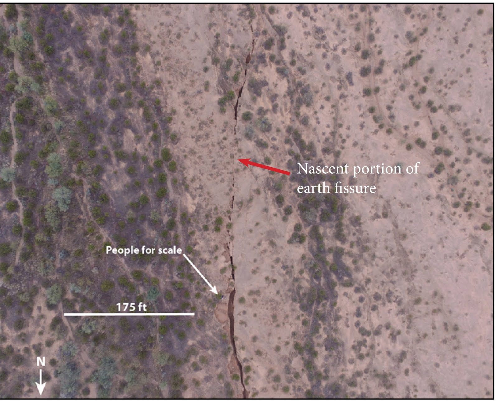
These fissures can be deep and dangerous to humans. They can often widen and deepen suddenly, particularly after heavy rains. They’ve ruined houses and highways, and for about a decade the Arizona government has been mandated to identify the locations of fissures and share that information with the public. Even after fissures are located, though, there’s not much to do about them, besides stay away.


Follow us on Twitter to get the latest on the world's hidden wonders.
Like us on Facebook to get the latest on the world's hidden wonders.
Follow us on Twitter Like us on Facebook